2.1. Region of Srem - Srem
Srem region is located on the slopes of the mountain Fruska Gora facing rivers Danube (on north) and Sava (on south). Inner border of Srem Region excludes higher - central part, more exactly peaks of the mountain Fruska Gora, which is part of the forest complex of the national park "Fruska gora", which with monasteries on the mountain represents uniqueness of the region.
GALLERY
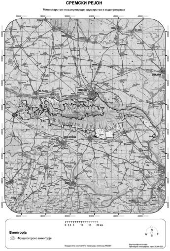
It expands from 45° 15' geographic latitude on north to 45° 00' geographic latitude on south, on altitudes from 70 m to 300 m. Area where vineyards are grown is on altitudes from 90 m to 270 m. Altitude of the region gradually decreases going from slopes of the mountain Fruska Gora toward edges of the region.
Region includes territory in the municipalities of Backa Palanka, Beocin, Novi Sad, Sremski Karlovci, Sid, Sremska Mitrovica, Ruma, Indjija, Stara Pazova and Irig.
Region is mostly characterized by moderate-steep to gentle slopes of the terrain there vineyards are located. Type of soil of this region is chernozem, with some euteric cambisol and rendzin, sirozem and litosol on limestones, as well as occasional other types of soil.
Topographic - relief characteristic are slopes of the mountain Fruska gora whose north, east, west, and south slopes belong to the region. Landscape characteristics of the region are under influence of the river Danube on the north side, and slopes of Fruska Gora covered in orchards, vineyards, arable crops, and forests.
River Danube has great influence on the region by making grapes ripen earlier due to increased diffuse radiation.
Region includes only one vineyard, vineyards of Fruska Gora.